Tikal – Temples and Pyramids in the Jungles of Guatemala
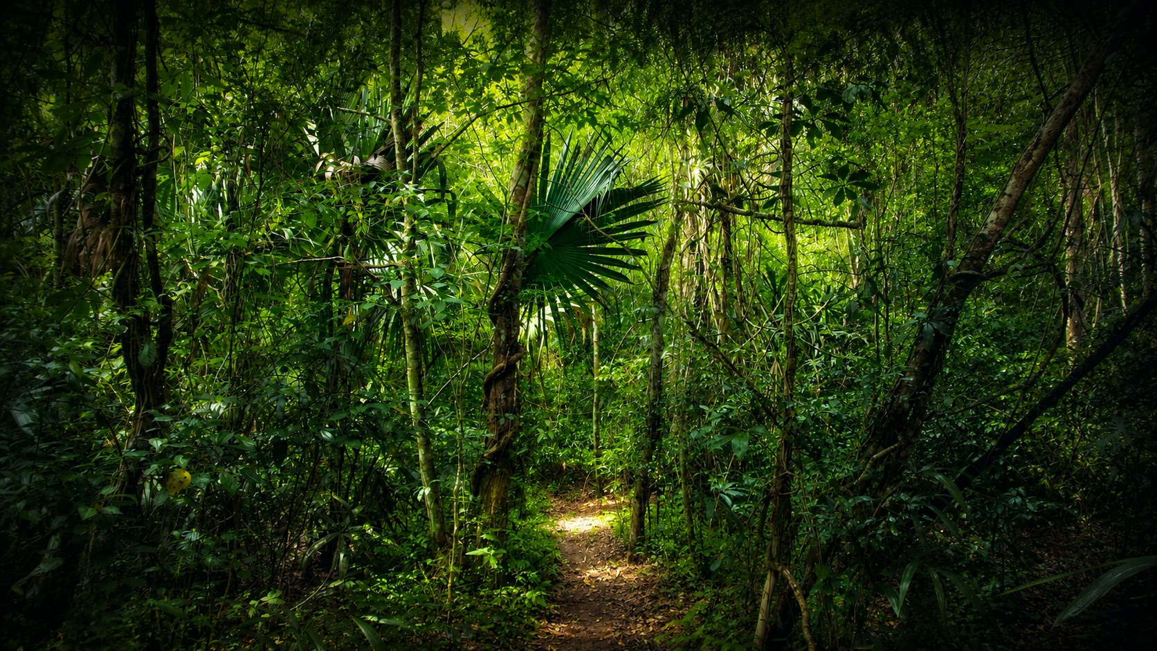
The Maya city of Tikal is only about 60km northwest of Florés, located on Lago Petén. It is situated in the middle of a vast nature reserve stretching from the Lago Petén to the Mexican border. The dense rainforest that surrounds the Maya site is typical for the southern lowlands of the Maya region and uniquely characterizes it. With a bit of luck, you can watch numerous animal and plant species during a visit to the site. For a good reason, then, Tikal has been granted both, the UNESCO World Nature Heritage and World Culture Heritage status by UNESCO.
Table of contents
- FIRST EXPEDITIONS TO TIKAL
- SITE DESCRIPTION
- SACBEOB – CEREMONIAL ROADS
- THE TEMPLES AND GROUPS OF BUILDINGS
- TEMPLE I – THE TEMPLE OF THE JAGUAR
- TEMPLE II – THE TEMPLE OF THE MASKS
- TEMPLE III – THE JAGUAR PRIEST’S TEMPLE
- TEMPLE IV – THE TEMPLE OF THE TWO-HEADED SNAKE
- TEMPLE V
- TEMPLE VI – THE TEMPLE OF THE INSCRIPTIONS
- THE NORTHERN ACROPOLIS
- THE CENTRAL ACROPOLIS
- GROUP H
- GROUP G
- MUNDO PERDIDO – THE LOST WORLD
- SQUARE OF THE SEVEN TEMPLES – PLAZA DE LOS SIETE TEMPLOS
- TWIN PYRAMIDS
- TEMPLE I – THE TEMPLE OF THE JAGUAR
- HISTORY OF TIKAL
- TRAVEL TIP
- Recommended Reading:
On the road to this probably best explored Maya city in Guatemala, one gets an impression of the lush nature, because the asphalted street lead through dense jungle over long distances. The treetops meet above, giving the idea of driving through a green tunnel. Every now and then, exotic traffic signs warn that snakes, coatis or jaguars could cross the road.

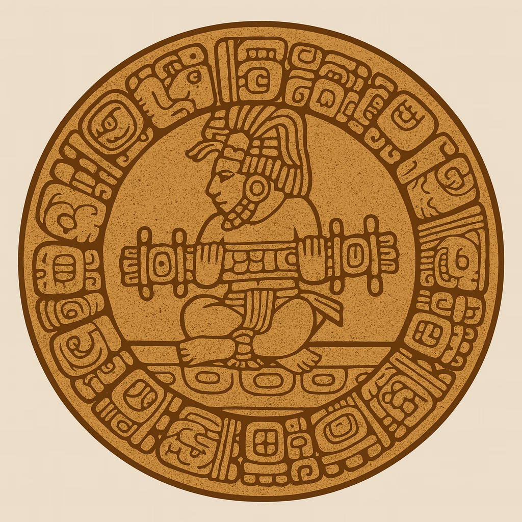
The original name in the Mayan language for Tikal was Yax Mutal. The researchers do not yet agree on the original meaning of the word. The emblem of Tikal contains the stylized image of a bundle tied together. Several different purposes have been discovered for the word stem “Mut”: omen, bird, braided plait or hair knot. The suffix -al was often used for places. Yax, in turn, means “first” and emphasizes the importance of Tikal in the ancient Maya world.
The word Tikal, on the other hand, is of modern origin. It was given to the place by rubber collectors. It might mean “place with a waterhole.”
The settlement of Tikal began in the pre-Cclassical phase around 900 BC. The first architectural traces date from this period and go back to 200 BC. This phase also marks the city’s first period of prosperity, which lasted until around 200 AD.
Tikal did not escape the general decay, which set in at the end of the pre-Classic period. But it survived the time and swelled to new heights during the classical period, while many other pre-Classic Maya cities were already wholly abandoned by their former inhabitants.

In this second heyday during the Classic period, the area controlled by Tikal might have provided living space for a total of 200,000 people, while the city itself and its immediate vicinity are thought to have been home to about 60,000 people. The actual detected urban area covers the footprint of 65km². So far, 6000 buildings have been identified. However, it is believed that more than 10,000 buildings are still waiting to be discovered. Using LiDAR technology, a type of 3-D laser scanning, scientists have detected thousands of ancient structures in the jungles of Guatemala and Mexico that have been unknown before.
Around 900 AD, at the end of the classical period, Tikal met the same fate as the other cities of the southern lowlands. The inhabitants abandoned the town and left it to decay.
FIRST EXPEDITIONS TO TIKAL
The first expedition to Tikal was carried out in 1848 by Modesto Mendez, governor of the province of Petén at this time, under the leadership of Ambrosio Tut. A written account of this expedition was published five years later as a German translation in a publication of the Akademie der Wissenschaften in Berlin. The next news of a traveler was announced by a Swiss doctor named Carl Gustav Bernoulli. He visited the ruins in 1877 and took some wooden door lintels, which he had found on site, with him to Switzerland. They can be seen in Basel today. Subsequently, Alfred Percival Maudslay (1881) and Teoberto Maler (1895 and 1904) visited the site and examined it more closely for the first time. After a visit by Alfred Tozzer and Raymond Merwin in 1910, silence returned to the jungle for a long time. It took until the 1950s when the regular inspection and restoration of the ruins began.

SITE DESCRIPTION
From the entrance of the site, after about 1.3km you reach the centrally located Gran Plaza. Several of the famous buildings are grouped along the four sides of this large square. Temples I and II are located on the east or west side of the square and are aligned with each other. North of the square is the Northern Acropolis, on the south, you find the Central Acropolis. The Central Acropolis probably served as a palace-like residence of the ruling family, while in the Northern Acropolis several graves with burial objects have been discovered and therefore it is believed that this building served as a burial place.
SACBEOB – CEREMONIAL ROADS
Four dams built by the Maya were found in the area of Tikal, called Sacbéob. Sacbeob is the majority of the Mayan word Sacbé, which translates as “white road.” They probably originated in the late classical period, but some of them date back to earlier times and connect several ceremonial centers with each other.
Three of the four Sacbéob, which are named after the famous firsttime visitors, lead from the center for peripheral monuments. The fourth Sacbeob connects two of these groups.
CALZADA MENDEZ
The Sacbé called Calzada Mendez leads, from the Plaza del Oriente behind Temple I, over a distance of 1.3km, past the buildings of Group G to the southeast to TempleVI, the temple of inscriptions.
CALZADA TOZZER
Behind Temple II, begins the Calzada Tozzer. It leads westwards past Temple III to Temple IV, about 500 meters away.

CALZADA MALER
The Calzada Maler directs from the Plaza del Oriente to the north, past the complexes R and Q, and reaches the complexes H and P. The distance is about 800 meters.
CALZADA MAUDSLAY
The fourth road, the Calzada Maudslay, connects Temple IV and the complexes H and P. It has a length of about 800 meters.
THE TEMPLES AND GROUPS OF BUILDINGS
The temple pyramids are usually numbered. However, some of them have specific proper names because of unique illustrations or inscriptions found there.
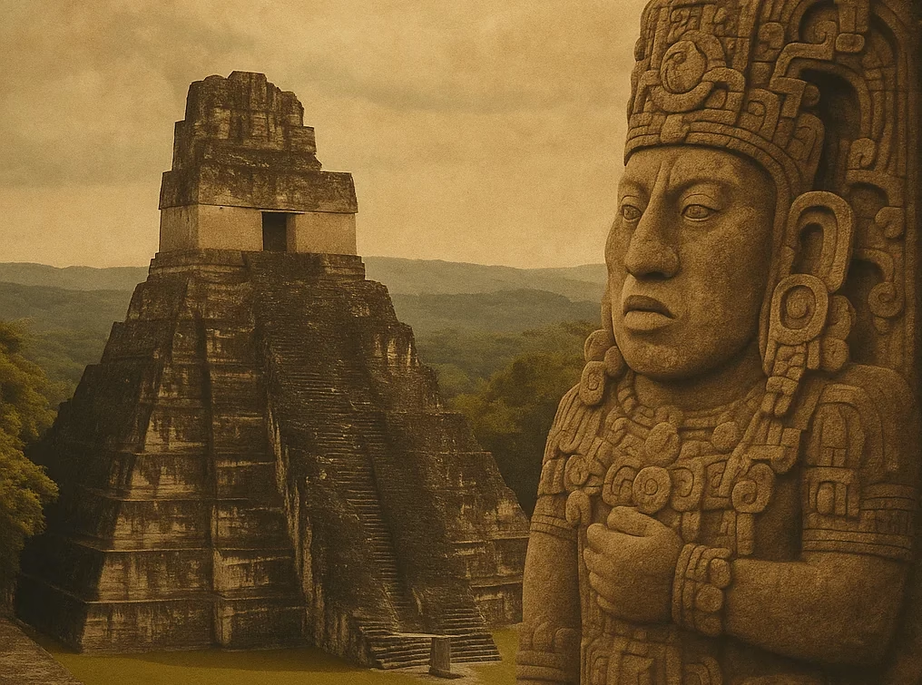
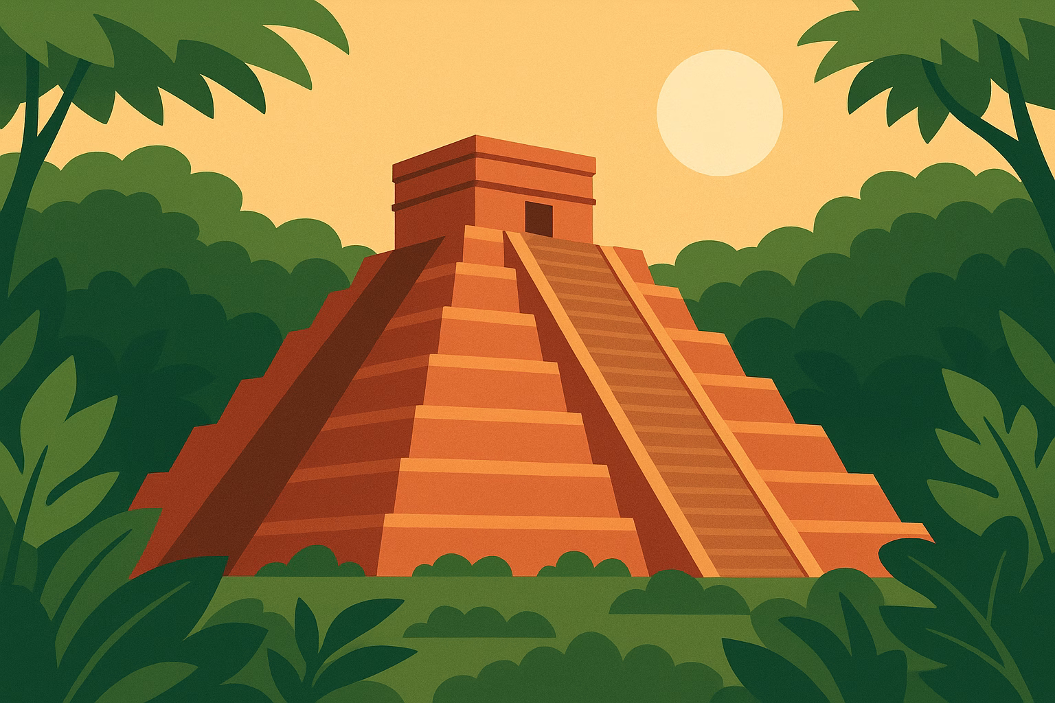
TEMPLE I – THE TEMPLE OF THE JAGUAR
This temple pyramid, located at the Gran Plaza, is basically Tikal’s landmark and, next to the Kukulkan pyramid of Chichén Itzá, it is probably the most famous pyramid of Mesoamerica.
It is 47 meters high and served as a burial place for a vital ruler of Tikal, Jasaw Chan K’awiil I, who ruled over the territory of Tikal in 682734. The building is realized as a regular pyramid with nine levels. It is assumed that the construction was completed around 732 AD. The front staircase has precisely 100 steps.
TEMPLE II – THE TEMPLE OF THE MASKS
This three-stage pyramid reaches a height of 38 meters. It stands opposite the Jaguar Temple on Gran Plaza. It is believed that this building was erected by Jasaw Chan K’awiil I as a tomb for his wife Kalajuun Une’ Mo’. The architecture of the building is similar to other buildings from the early classical period, but of course, it was constructed at about the same time as the jaguar temple.
TEMPLE III – THE JAGUAR PRIEST’S TEMPLE
Temple III was completed around 810 AD, during the late classical period. As the only one of the pyramids in Tikal, the actual temple shrine on top has only two instead of the usual three rooms, as have been found in the other temple pyramids in the city. The height of the structure is 55 meters.
The monument was erected during the rulership of a king whose real name is unknown. Due to the hieroglyphic inscriptions found there, archaeologists call him “Dark Sun.” He ruled during the time in which the pyramid was built.
TEMPLE IV – THE TEMPLE OF THE TWO-HEADED SNAKE
At 65 meters, Temple IV is the tallest building in Tikal. His builder is Yik’ in Chan K’awiil, who possibly ruled from 734 AD to 766 AD. Inside the temple pyramid, the tomb of this ruler is believed to be located, but an excavation into the interior has not yet taken place. The building was completed around 741 AD. From the upper platform of the pyramid, a scene for the movie “Star Wars – Episode IV” was filmed in 1977 and shows the temples at the Gran Plaza that protrudes above the surrounding jungle.
THE ASTRONOMICAL SIGNIFICANCE OF TEMPLE IV
But the view of Temple IV was not only interesting for George Lucas. The Maya also knew how to use the elevated location for their purposes. The alignment of Temple IV to Temple I took place according to astronomical aspects. From Temple IV you can see the rising sun on February 12th, and October 30th in the ridge of Temple I. The two dates are essential for the Tzolkin calendar, a calendar used by the Maya. The distance between the two days is exactly 260 days, which corresponds to the length of the Tzolkin calendar. The calendar system of the Maya is described later in this book.
TEMPLE V
This temple is the second highest of Tikal’s temples, 57 meters high. The construction time is assumed in the late classical period during the 7th century. Possibly, it was built during the reign of Nuun Ujol Chaak, who ruled from 650 – 679. On its left-hand side, an almost 50-meter-high extremely steep wooden staircase leads to the upper platform. The view is breathtaking, but so is the ascent. And when you then stand on the stairs again to climb down, it will catch your breath again. You should definitely be free of vertigo, especially since there are no barriers on the platform.
TEMPLE VI – THE TEMPLE OF THE INSCRIPTIONS
The Temple of the Inscriptions is believed to have been a palace building rather than a temple. It got its name from a series of engraved hieroglyphic texts on the sides and the back wall. The dates recorded in these inscriptions date back to the pre-Classical period and refer to a possibly mythical city founder of Tikal. His name was White-Owl-Jaguar with an accompanying date of 1143 BC. The construction period dates back to the first half of the 8th century, probably under Jasaw Chan K’awiil I. The monument was built in the middle of the 8th century. A stele found in front of the temple describes his son Yik’in Chan K’awiil ascent to the throne.
THE NORTHERN ACROPOLIS
The Northern Acropolis on the north side of the Plaza Major is one of
Tikal’s oldest structures. Around 350 B. C., towards the end of the Middle Pre-Classicism, the first construction works for the base on which the northern Acropolis was built were documented.
However, finds indicate that this place was used for ceremonies as early as 800 BC. At the end of the pre-Classical period, during the 1st century AD, the first burial took place. It is assumed that this is the grave of the dynasty founderYaxEhb’ Xook, who ruled around 90 AD.
Later graves of Tikal’s rulers date from the classical period. A total of 43 stelae and 30 altars were found in Tikal, many of them with inscriptions that allow the individual graves to be assigned to specific rulers.
One can see that the Northern Acropolis was used as a necropolis or graveyard for the ruling dynasty.
The Northern Acropolis measures about 100 by 80 meters at its base. Its surface, 12 meters above the Plaza Major, can be reached via several stairs on the south side. In the following centuries, numerous temples which were often used as burial places were built on the platform. Unfortunately, many of them were plundered by grave robbers, an activity that started soon after Tikal’s demise. Some of these smaller temples still reach impressive heights, such as Temple 33 at 33 meters.
THE CENTRAL ACROPOLIS
The Central Acropolis is located on the south side of the Plaza Major. As for the Northern Acropolis, construction activities began around 350 BC in the pre-Classical phase. The older buildings were partly over-built in later times. The function of the central acropolis differs markedly from that of the northern one. It served the aristocratic ruling families as their residence. A total of 43 structures have been identified in the area. Among some of them, burial traces could be found. In many cases, it was common for family members to be buried under the floor of their own home. Where these burials are missing, it is assumed that the structure in question has not been used as a residence but as an administrative building.
Maler’s Palace – a building structure, also called 5D-46, was probably the residence of the king. It was built around 350 AD.
GROUP H
Located on the north-eastern periphery, Group H can be reached via the Calzadas Maudslay and Maler. In both cases, the distance is about 800m. So there and back add up easily to 1.6km, without taking into account the walking around temples and other structures. The building structures you can see there date back to the late classical era.
GROUP G
Walking along the Calzada Mendez in the direction of Temple VI, you will pass Group G, which is located to the right of the path. This is a significant palace district. There are inner courtyards and two-story residential buildings. A total of 29 vaulted chambers have been discovered here.
MUNDO PERDIDO – THE LOST WORLD
The Square of the Seven Temples and the Mundo Perdido group of buildings are located south-west of the Gran Plaza in a short distance and are not connected to the center by a Sacbé.
With a footprint of 60,000sqm, this is one of the most massive structures in Tikal. The name “Mundo Perdido – The lost World” was given to it by the archaeologists of the University of Pennsylvania, who conducted the first investigations here.
There have been six construction phases. The beginnings of building activities date back to 700 BC during the pre-Classical period. In later times, the complex was extended and built over again and again. Works that took place between the 4th and 6th centuries clearly show the influence of Teotihuacan, a Meso-American culture in the high valley of Mexico, which at times had a significant impact on the Maya territory. The architectural peculiarity of this influence is the Talud-Tablero style, known from Teotihuacan. During the gradual construction of the pyramid structure, vertical sections (tablero = board) alternate with inclined sections (talud = slope). The temple, numbered 5C-49, is an example of this construction method and at the same time the second most significant structure of the group.
The center of the Mundo Perdido complex is “The Great Pyramid” or
“Lost World Pyramid.” It is 31 meters high. At its base, it measures almost 70 meters and is thus the most extensive construction project ever to have taken place in Tikal. A total of 5 superstructures have been found. The beginnings here also date back to the pre-Classical phase.

The Skull Temple or Templo de las Calaveras is the third largest structure of the Mundo Perdido complex. Here too, several superstructures have been found. Numerous graves detected in this complex indicate that for a long time, Mundo Perdido served as a necropolis for the ruling class as the northern Acropolis.
SQUARE OF THE SEVEN TEMPLES – PLAZA DE LOS SIETE TEMPLOS
West of the central Acropolis and south of Temple III, is the Square of the seven temples – Plaza de Los Siete Templos. There are some smaller temples on the eastern side of the square. The area has an area of 25000sqm, which makes it the third largest square in Tikal. Construction work began in the Pre-Classic period during the 7th century BC.
TWIN PYRAMIDS
A total of nine twin pyramid complexes have been discovered in Tikal. These are small pyramids with a platform that can be reached via four stairs on each of the four sides corresponding to the cardinal points. Two of these pyramids are arranged on the east and west side of a square respectively. Due to inscriptions, we know the years in which each of these pyramids was erected. Each couple of twin pyramids was named with a letter, as Group M, N, O, P, Q, and R.
It is noticeable that these data are exactly 20 years apart and mark the change of the Katun at that time. Apparently, they were built on the occasion of this change for ceremonial reasons. The twin pyramids can be found in different places in Tikal’s urban area.

Similar twin pyramids have been detected in only three other places. One of them in Yaxhá, one in Ixlu, at the bottleneck between Lago Petén and Lago Salpeten near El Remate and two others in Zacpetén, on a peninsula in Lago Salpeten. No twin pyramids have been found yet outside this area near Tikal.
HISTORY OF TIKAL
Thanks to numerous well-preserved inscriptions on stone tablets, we are better informed about the classical phase of Tikal than of other ancient Maya cities. This is true especially for the Classic phase during which the inscriptions were created. For the time before or after this period archaeologists have to rely on spade finds to get at least a rough overview.
PRE-CLASSICAL PERIOD
The first agricultural activities were found in the Middle Pre-Classic, around 1000 BC. Ceramic remains found among the oldest buildings date back to 800 BC. Construction work on the oldest structures in Tikal began very early, approximately 650 BC, as it is assumed for the Square of the Seven Temples and the Mundo Perdido Group.
At that time, Tikal’s influence in the region was still small, and its importance was overshadowed by the power and splendor of El Mirador and Nakbe, which were the power centers of the Maya area during the pre-Classical phase.
CLASSICAL PERIOD
A total of 33 rulers were found in Tikal. They reigned and steered the fate of the city for 1800 years. The dynasty founder was probably Yax Ehb Xook, whose reign fell into the late pre-Classical period, the 1st century AD.
The first centuries of the early classical period were marked by warlike activities, which involved not only Tikal but also Uaxactun, Caracol, Calakmul, and Naranjo.
In 378 AD, an invasion by an army of Teotihuacan in Tikal took place. The current 14th ruler “Jaguar claw” Chak TokIch’ aak I was deposed by the foreign military power and probably executed immediately. In his place “The first crocodile” – Yax Nuun Ahiin I took the throne. Apparently, the crocodile was a son of the ruler of Teotihuacan, Atlatl
Cauac, which means “the owl that strikes” and which historians call the “spear-chucking owl,” too.
The following rulers were able to expand their sphere of influence. Uaxactun was incorporated into the kingdom, Rio Azul was conquered, and other towns on Lago Petén became politically dependent on Tikal.
At the end of the 5th century, the power of Tikal even reached into the present-day border area of Guatemala and Honduras. Not only the foundation of Copan but also the beginning of a ruling dynasty there can be traced back to Tikal’s initiative under the influence of Teotihuacan. At the same time, the city of Quirigua was founded near Copan.
In the 6th century, a long-lasting war with Calakmul began. Around 562 AD, an alliance between Calakmul and Caracol Tikal succeeded in conquering and killing the reigning king. This date marks a time which is called “Hiatus of Tikal” by historians. Characteristic of the Hiatus is that during about 120 years no new inscriptions were created.

The Northern Acropolis and Temple II
Part of Tikal’s ruling class seems to have succeeded in saving themselves at the court of Palenque.
However, Calakmul’s control of Tikal was incomplete and only temporary. Although Tikal’s power was initially broken and his sphere of influence was significantly reduced, it was not extinguished.

About 70 years after the defeat in 629 AD, Tikal founded the military outpost of Dos Pilas, thus gaining control of the critical trade route along the Pasíon River. Dos Pilas was apparently a thorn in Calakmul’s side. After 30 years, in 657 AD, it was conquered by Tikal’s rival. The king of Dos Pilas, who descended from the dynasty of Tikal, changed sides, joined Calakmul and launched an attack, which was almost fatal for Tikal. But the subsequent counterattack by Tikal led to the expulsion of the ruling king.
After the break of 120 years, the next inscription in Tikal was made in
682 AD. Jasaw Chan K’awiil I., who had built the temples I and II at the Gran Plaza, finally succeeded in defeating Calakmul in 695 AD and captured its ruler. Calakmul was stricken in a way that the decline of this once mighty city was sealed. After this defeat, there were no more inscriptions in Calakmul. Until then, the war had lasted for almost 150 years and thus covered the entire Hiatus period.
During this time, Teotihuacan’s influence on Tikal and the rest of the Maya region gradually diminished and eventually ended completely. The city in the high valley of Mexico, which had been influential for many centuries, was destroyed around 700 AD and abandoned by its inhabitants. The exact reasons for the sinking of Teotihuacan have not yet been clarified, but the cause is believed to be a people‘s uprising.
The 8th century saw some construction activity in Tikal, but the number of inscriptions gradually decreased.
869 AD, the last inscription was finally written. The population number steadily melted away and around 950 AD the city was mostly abandoned.
TRAVEL TIP
From the bus station in Flores/St. Elena, you can quickly reach Tikal by public transport. The journey in the colectivo takes about one hour. You should have good shoes and enough drinking water with you to visit this Maya city. The routes within the area are relatively long. It is 1.3km from the entrance to the Plaza Major. If you plan to see all the famous temples, then you have to cover almost 6 km. Consider that some of the pyramids and temples can also be climbed, so that it is easy to add 100 meters of altitude to the hike.
Recommended Reading:
A description of the amazing experience to visit Tikal can be found on the Website of Marcella and Claire – “Best regards from far“: Tikal: where nature and culture merge


Tikal was by far the most impressive temple I visited in the Yucatán area – it doesn’t just feel like being a “tidily dug out archeological site presented on a silver platter” for tourists to see. Especially the walking up of the jungle (howler monkeys going nuts) was an awesome experience -> Get there before sunrise! Have to return there someday and visit El Mirador.