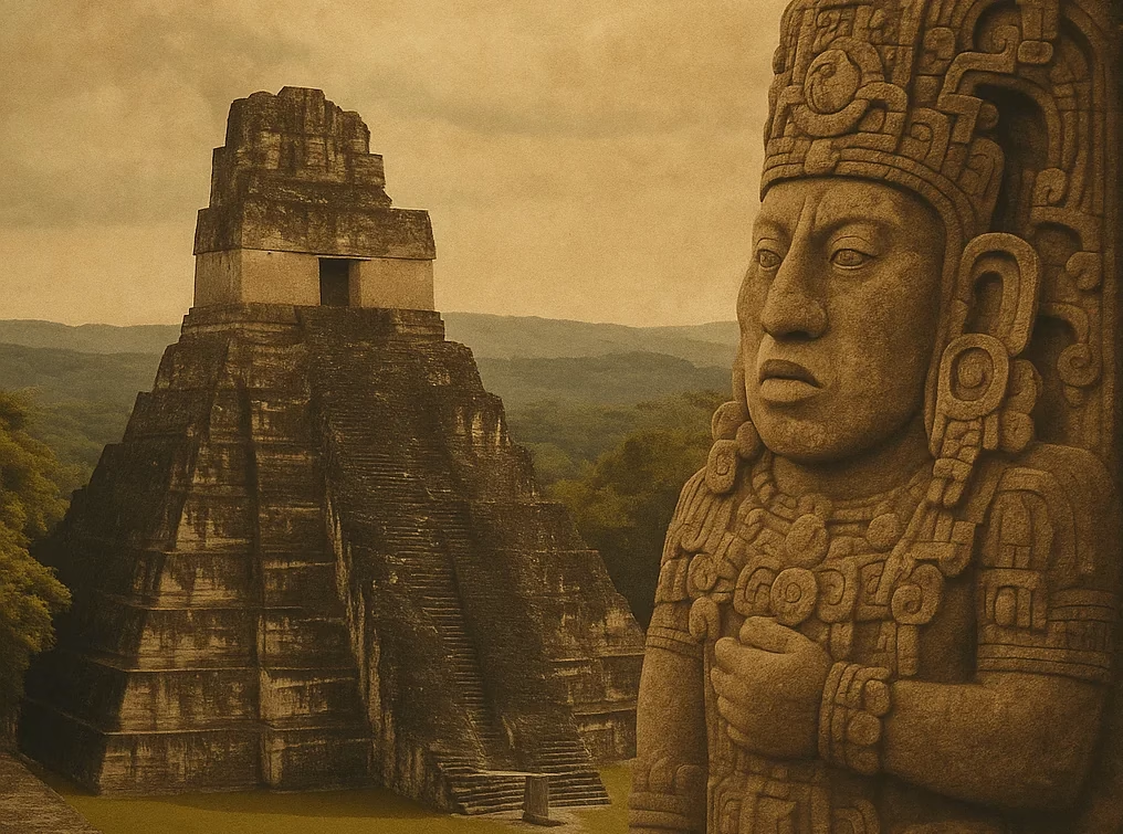
Water for the Gods – How the Maya Directed the Rain
The latest LiDAR mapping of the Maya city Ocomtún brings a fascinating topic into focus: the water management of the ancient Maya. In the dense jungle of today’s state of Campeche, it becomes clear that the Maya built far more than just pyramids. Archaeological evidence suggests they also constructed complex hydraulic systems with dams, canals, holding basins, and drainage networks—even though individual findings still need verification.
This discovery is not an isolated case. In cities such as Tikal, Edzná, Palenque, and Calakmul, recent research likewise reports hydraulic installations that apparently served more than just supply functions. Much indicates that water formed the heart of urban planning, ritual practice, and political control. The variety of these systems opens a new perspective on the connection between technology, cosmology, and daily life in pre-Columbian Mesoamerica.
Time to explore this topic in more detail.
![LiDAR map of Tikal with highlighted reservoirs.
Hill-shade base layer: Francisco Estrada-Belli (PAQUNAM LiDAR Initiative); annotations by Christopher Carr & Nicholas Dunning.
Adapted from Lucero et al. 2023, Ancient Maya reservoirs, constructed wetlands, and future water needs (PNAS 120 [7]: e2306870120), Figure 2.
License: CC BY 4.0 (https://creativecommons.org/licenses/by/4.0/)](https://amazingtemples.com/wp-content/uploads/2025/07/LiDAR-map-of-Tikal-highlighting-some-of-its-reservoirs-adapted-from-ref-59-figure-2.avif)
Hill-shade base layer: Francisco Estrada-Belli (PAQUNAM LiDAR Initiative); annotations by Christopher Carr & Nicholas Dunning.
Adapted from Lucero et al. 2023, Ancient Maya reservoirs, constructed wetlands, and future water needs (PNAS 120 [7]: e2306870120), Figure 2.
License: CC BY 4.0 (https://creativecommons.org/licenses/by/4.0/)
Tikal – The Reservoirs of the Kings
In the heart of the Classic Petén lowlands, at least ten large reservoirs are found in Tikal, including the imposing Corriental Basin near the central ceremonial zone. Their placement along the city’s main axes creates a spatial link to pyramids and palaces, possibly reflecting a deliberate symbolic staging.
Archaeohydrological studies over the past two decades show that the Maya not only collected rainwater and surface runoff but also apparently treated it. In the Corriental Reservoir, researchers documented layers of zeolite- and quartz-rich sand—natural materials with filtering properties. This makes Tikal one of the earliest documented drinking-water filtration systems in the Maya world.
The filtration was multi-stage: sedimentation basins allowed coarse particles to settle, while fine substrates reduced biological and chemical contaminants. Pollen and DNA analyses point to recurring algal blooms—likely triggered by bird droppings, organic inputs, and seasonal fluctuations. This illustrates the challenge of maintaining clean water over time.
Topographic modeling also shows that the Maya shaped the terrain so that rainwater from the acropolis flowed into the basins. Small dams and stone channels regulated inflow and outflow. Ceramics fragments, jade beads, and organic sacrificial remains in the sediments of some reservoirs indicate ritual use.
Tikal thus stands as a prime example of technically sophisticated yet symbolically charged water architecture of the Classic Maya period.
Tikal Reservoirs in Numbers
To illustrate how much water the metropolis could actually hold, the following table summarizes all currently named reservoirs. Alongside their location and function, you’ll find—where known—the estimated capacity and the converted size in “Olympic pools.” This comparison makes the Maya’s engineering feat tangible.
| # | Name | Location & Brief Characteristics | Main Function(s) | Volume (≈ m³, rounded) | ≈ Olympic Pools* |
|---|---|---|---|---|---|
| 1 | Temple Reservoir | South of the Great Plaza, highest elevation | Drinking & Ritual Water | 27 000 | 10.8 |
| 2 | Palace Reservoir | SE edge of the central acropolis | Largest Core Basin | 74 000 | 29.6 |
| 3 | Hidden Reservoir | Below the Palace Dam | Buffer/Check Basin | n/a | n/a |
| 4 | Corriental Reservoir | NE fringe of the core district | Filtered Supply Basin | 58 000 | 23.2 |
| 5 | Perdido Reservoir | SE of the ceremonial core | Buffer & Field Irrigation | 5 000 | 2.0 |
| 6 | Términos Reservoir | E-SE edge, bajo rim | Peripheral Basin | n/a | n/a |
| 7 | Tikal Reservoir | SE bajo rim | Main Storage, Agricultural Tank | n/a | n/a |
| 8 | Inscription Reservoir | Near Temple VI | Natural sinkhole, expanded | n/a | n/a |
| 9 | Madeira Reservoir | NW Quadrant (Square 6D) | Neighborhood Basin | n/a | n/a |
| 10 | Camp Reservoir | West of the acropolis | Tertiary/Experimental Tank | n/a | n/a |
| Σ (known volumes only) | — | — | — | ≈ 164 000 | ≈ 65.6 |
*An Olympic-size standard pool (50 m × 25 m × 2 m) holds ~2 500 m³.
Notes
- The volumes derive from recent modeling and core-drill data; sediment infill and dam erosion can cause ±10 % variation.
- Published capacity data are still missing for Hidden, Términos, Tikal, Inscription, Madeira, and Camp; ongoing sediment analyses may provide those in the future.
Edzná – Water Rules the City
The city of Edzná in Campeche illustrates the close integration of urban planning, environmental adaptation, and religious symbolism. Founded as early as the 4th century BCE, it developed into a significant metropolis with an extensive water infrastructure system.
Numerous canals, artificial platforms, and dams define the center. Noteworthy is the Nohochná Canal, which leads out from the ceremonial zone and, via a gentle gradient, flows into a lower holding basin. This system apparently served multiple functions: draining during heavy rains, storing water in the dry season, and likely holding ritual significance.
Some channels and platforms may align with solar positions on specific calendar dates, though this interpretation remains debated and requires further data. What is certain is that Edzná’s location in a semi-arid valley demanded technical ingenuity. Sediment-trapping layers in canals acted as natural filters, and stepped weirs helped regulate water pressure. Recent studies also show that rainwater was directed from rooftops into central cisterns—a technique Edzná shares with Puuc sites like Uxmal.
Edzná thus stands not only for cultural splendor but also for an early example of environment-adapted urban development under challenging conditions.
Palenque – An Early Pressurized Water System in the Americas?
Palenque lies at the foot of forested hills in northwestern Chiapas. The city captivates with its intricate architecture and richly decorated temples—and its water technology. The Otulum River was channeled by the Maya into underground canals (piedras canalizadas) made of precisely fitted stone slabs, conveying water beneath the palace complex.

Photo: Ricraider, 7 June 2012 — Licensed under CC BY-SA 3.0 (https://creativecommons.org/licenses/by-sa/3.0/)
Controversially, this system is considered one of the earliest known pressurized water installations on the continent. It allowed water to be lifted to higher platforms and kept the core area dry. Some researchers even debate whether sufficient pressure could have powered small fountains—though this hypothesis remains unverified.
Moreover, the flowing water under the royal palace likely held symbolic meaning. It may have represented the connection between the world of the living and the underworld (Xibalba). Thus, Palenque was architecturally and spiritually intertwined with its water landscape.
Other Sites at a Glance
| Site | Notable Feature |
|---|---|
| Calakmul | Cisterns, extensive aguadas (up to 5 ha), likely natural in origin |
| Copán | River diversions, terraced basins |
| Yaxchilán | Rainwater basins in rock formations |
| Caracol | Central reservoirs, drainage systems |
| Uxmal | Chultunes (underground cisterns) |
Ocomtún – New Insights from the LiDAR Lab
Only in 2023 did a LiDAR project led by archaeologist Ivan Šprajc reveal Ocomtún. The settlement lies deep in the remote rainforest of the Balamkú Biosphere Reserve. Laser scans uncovered monumental architecture and—most intriguingly—a seemingly sophisticated network of canals, holding basins, dams, and probable drains.
The documented channels partly follow natural depressions, while others appear artificially cut. Their length and interconnectivity are under study. Initial analyses suggest they linked ceremonial platforms, residential areas, and lagoon-like hollows. If confirmed, water here may have served not only functional but also urban-design purposes.
Several elongated depressions with deepened basins stand out, interpreted as temporary reservoirs. Geomorphological data indicate that rainwater was intentionally channeled from higher terraces into these basins—for supply and possibly ritual cleansing. Final results are still pending.
Ocomtún thus adds a new piece to our understanding of early Maya water architecture, underlining water’s role as a potential organizing principle in the Preclassic lowlands—even as questions remain.

Water as a Source of Power – Mythology, Agriculture, and Rule
In the Maya cosmos, water was more than a resource. It acted as a sacred substance and medium between Upper, Middle, and Underworlds. Springs, caves, and subterranean rivers were seen as portals to Xibalba, where rituals, oracles, and sacrifices took place.
Water & Mythology
Many Maya creation myths, such as those in the Popol Vuh, tell of the world’s emergence from a primordial flood. The rain- and fertility god Chaak was central, wielding his axe to bring lightning and rain. Droughts prompted ceremonies in caves, cisterns, or sacred springs (cenotes) to invoke Chaak. At Chichén Itzá, human sacrifices in the Cenote Sagrado are well documented by artifacts and human remains.
Water & Agriculture
The tropical environment offered fertile soils but a highly seasonal water supply. To cultivate maize, beans, squash, and chili, the Maya developed various water-dependent techniques:
- Bajo Cultivation – temporarily flooded depressions were planted after waters receded.
- Terraced Fields with Drainage – evidenced at Copán and in karst regions.
- Irrigation Canals – documented in Edzná, Ocomtún, and Calakmul.
- Aguadas – holding basins storing water and enabling aquaculture.
In the water-scarce Puuc region, cistern systems prevailed, while lowland cities relied on open reservoirs. Cisterns (Chultunes) collected roof runoff via channels into underground chambers.
Fish Farming & Aquatic Food Sources
Sediments from Tikal and Calakmul contain remains of Astyanax fish, snail shells, and tadpoles. This may indicate that some reservoirs were used for fish and amphibian husbandry. Alternatively, these species may have colonized naturally.
Wastewater & Drainage
The Maya developed systems to channel off wastewater—crucial in large cities. In Palenque, underground canals carried both fresh and greywater away. In Edzná and Calakmul, channels directed floodwaters into downstream fields, depositing sediments—an early form of ecological recycling.
Water & Political Control
Evidence suggests water was central to urban planning, rituals, and political control. The ability to store and distribute water was a symbol of royal power. Rulers depicted themselves as “Rain-Givers” or “Guardians of Water.” In Tikal, the Corriental Reservoir’s integration into the urban axis was a statement of politico-religious authority.
Cinnabar and Water
The red cinnabar (HgS) layers in tombs, on elite masks, and selective wall/plaster surfaces—as well as elevated mercury levels in some reservoir sediments—show that water infrastructure also directed material cycles.
Cinnabar did not occur locally in the limestone lowlands; it was sourced from richer highland deposits (e.g., central Mexican districts). Beyond ritual sprinkling, it was applied to bodies, objects, and plaster layers or placed in vessels. Weathering and runoff washed particles from stairs, platforms, and courtyard floors into channels and reservoirs—a chemical fingerprint of the interplay between ritual, trade, and water management.
Droughts as a Research Factor
Paleoclimate studies show that multi-year droughts—especially the so-called Late Classic Drought (c. 820–950 CE)—had a significant impact on Maya societies. Reservoir cores, stalagmite isotopes, and pollen profiles document periods of extreme water scarcity, during which basins silted up and agricultural yields collapsed. Such crises are considered key factors in political instability and city abandonment.
Current models combine LiDAR mapping with climate data to trace how droughts altered water infrastructure, settlement density, and ritual activity—making water research also climate research, and revealing both the adaptability and vulnerability of Maya cities.
Archaeology Meets Hydrology
Modern research combines various techniques to decode Maya water networks:
- LiDAR (Light Detection and Ranging) – reveals subtle terrain features.
- Sediment & Pollen Analyses – document usage history and water quality.
- Geoelectrical & Magnetometry – detect underground structures noninvasively.
- Microbiological Studies – reconstruct reservoir flora and fauna.
- Protein Analyses from Clay Tubes or Offering Vessels – uncover ritual contents.
- Drones & Photogrammetric 3D Models – visualize watercourses in high resolution.
This interdisciplinary approach unites natural and cultural sciences to reveal once-hidden water networks.
Conclusion: Directing Rain, Shaping Cities
The Maya’s water management was technologically advanced, ecologically adapted, and spiritually infused. The findings from Ocomtún shed new light on early forms of urban organization. Why advanced filters were used only regionally remains unclear—no filtration systems have yet been identified at Calakmul or Caracol. Today, visitors to Tikal, Edzná, or Palenque see ruins—but beneath the ground lie enduring testaments to the engineering prowess of a vanished civilization.
FAQ – Maya Water Management
They channeled runoff from plazas, roofs, and slopes via canals, stepped weirs, and small dams into tiered sedimentation basins and large reservoirs (e.g., the Corriental or Palace Reservoir in Tikal).
Yes. In Tikal, zeolite- and quartz-rich sand layers served as natural filters—one of the earliest known potable-water filtration systems in the region.
Water was seen as a medium linking Upper World, Earth, and Underworld (Xibalba). Cenotes, caves, and springs acted as portals; rituals for the rain god Chaak aimed at fertility and stability.
Multi-year droughts (e.g., in the 9th century CE) strained reservoir volumes, exacerbated algal blooms, and reduced crops—factors contributing to Late Classic political instability.
Yes. In the water-scarce Puuc hills, chultunes (cisterns) collected roof runoff; in the central lowlands, large open reservoirs and aguadas fed by canals predominated.
Rulers integrated reservoirs and canals into ceremonial axes, portrayed themselves as ‘Rain-Givers,’ and controlled water distribution and quality as an element of their legitimacy.
LiDAR reveals structures; sediment and pollen analyses show usage and water quality; geoelectrical & magnetometry detect underground channels; microbiology & DNA characterize biota; 3D models simulate flows.
Cinnabar (HgS) was not locally available and imported from highland deposits. Ritual applications on tombs, objects, and plaster were washed into channels and reservoirs—a chemical indicator of long-distance trade and material cycles.
No. They also served for ritual deposits, possible fish/amphibian husbandry, sediment trapping for fields, and as symbolic landscape elements.
For several basins, published volume data are not yet available because sediment cores, erosion measurements, and LiDAR-based modeling are ongoing. Future studies are expected to fill these gaps.
Photos to follow: LiDAR view of Ocomtún, reservoir in Tikal, canal in Palenque, map of water sites in the lowlands.
References
Andrews, E. Wyllys V. 1984. Edzná, Campeche, Mexico: Settlement Patterns and Monumental Architecture. Middle American Research Institute, Tulane University.
Connell, Jason B. 2022. “Bajo sediments and the hydraulic system of Calakmul, Campeche, Mexico.” Geoarchaeology 37(4): 641–660.
Dunning, Nicholas P., Vernon L. Scarborough, Timothy M. Beach et al. 2023. “Ancient Maya reservoirs, constructed wetlands, and future water needs.” PNAS 120(7): e2306870120.
Estrada-Belli, Francisco, Thomas Garrison et al. 2019. “Airborne LiDAR survey of the Maya Biosphere.” Journal of Archaeological Science 110: 104980.
French, Kirk D. & Christopher J. Duffy. 2011. “Maya plumbing: first pressurized water feature found in the New World.” Journal of Archaeological Science 38(5): 1150–1155.
Larmon, Kelly, J. Christopher A. Whitmore et al. 2023. “Ancestral Maya domesticated waterscapes, ecological aquaculture, and integrated subsistence.” Ancient Mesoamerica 34(2): 235–259.
Lentz, David L., Kenneth B. Tankersley, Nicholas P. Dunning et al. 2020. “Molecular genetic and geochemical assays reveal severe contamination…”